ShopDreamUp AI ArtDreamUp
Deviation Actions


Description
-------------------------------------------------------------------------
This image is part of series: Imperium Romanum Series
-------------------------------------------------------------------------
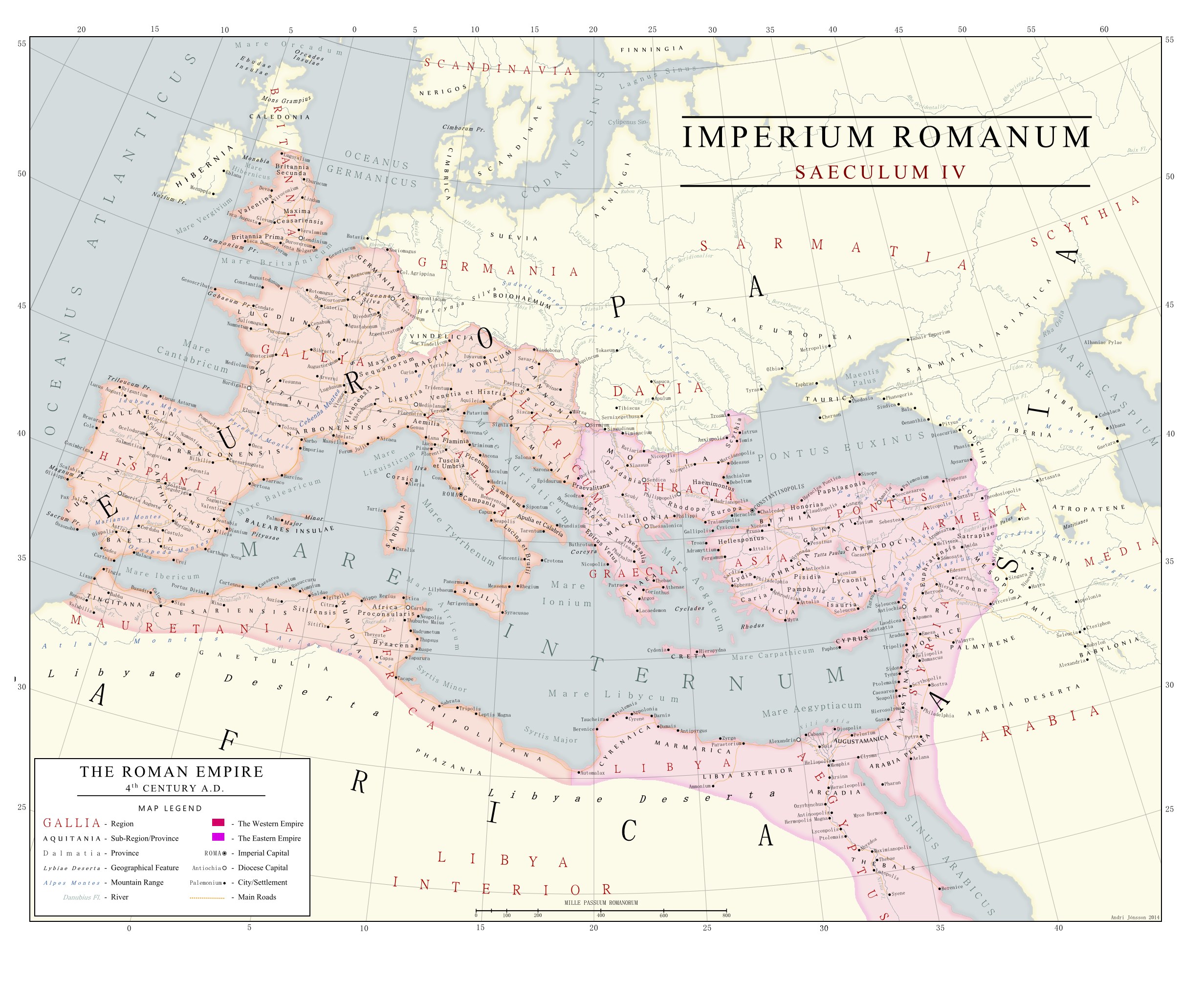
This map depicts the Roman empire in is completeness, i.e. not divided into east and west.
This map depicts the Roman Empire in the 4th Century A.D. and the known world around the empire. The Eastern and Western Empires are illustrated as well. Note: Placenames on this map are not designed to represent actual roman provinces as administrative divisions, but are purely geographical entities.
I used a whole bunch of other maps as reference material, some of them from the early 19th century, and an old book of ancient geography.
This image is part of series: Imperium Romanum Series
-------------------------------------------------------------------------
This map depicts the Roman empire in is completeness, i.e. not divided into east and west.
This map depicts the Roman Empire in the 4th Century A.D. and the known world around the empire. The Eastern and Western Empires are illustrated as well. Note: Placenames on this map are not designed to represent actual roman provinces as administrative divisions, but are purely geographical entities.
I used a whole bunch of other maps as reference material, some of them from the early 19th century, and an old book of ancient geography.
Image size
2463x2007px 1.9 MB
© 2014 - 2024 Kuusinen
Comments23
Join the community to add your comment. Already a deviant? Log In
may I ask why is Attalia on the map but Perge isn't?